Superstition Lava and Pyroclastic Flows
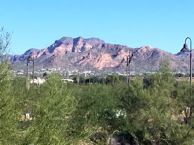
The image below shows the view from the indoor running track of the Apache Junction Multi-Generational Center, looking to the northwest toward the hills that make up the Goldfield Mountains. The homes that can be seen at the base of these hills are part of the city of Apache Junction which is contiguous with the community of Gold Canyon, where I live.
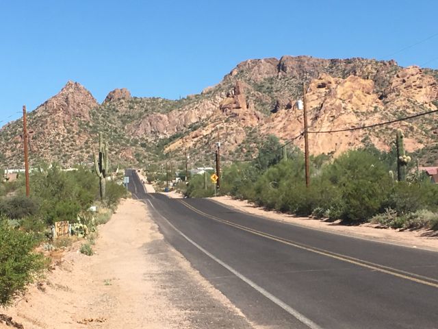
The image below shows the view looking northward on Idaho Road in Apache Junction, Arizona, toward the volcanic deposits of the Goldfield Mountains. The volcanic deposits east of Usery Pass Road are called the Goldfield Mountains, whereas those west of that road are called the Usery Mountains. Both are associated with the volcanism that is responsible for the formation of the Superstition Mountains, which are located just a few miles to the east.
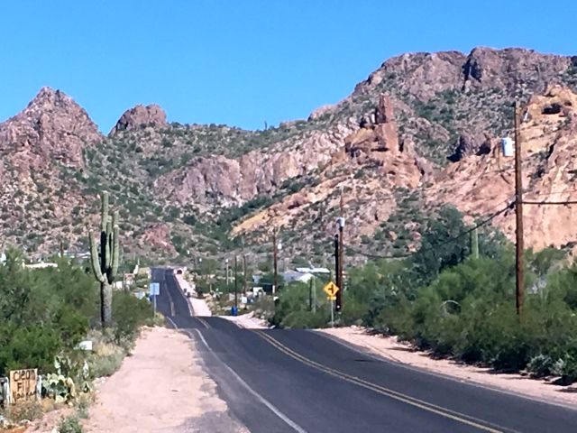
The image below is a closer view of the features shown in the above image. The base of the volcanic deposits are well exposed near the bottom of the thick volcanic sequence that makes up these hills.
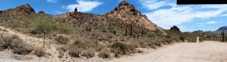
The image below shows the panoramic view looking north and east at the northern terminus of Idaho Road. The light-colored rocks in the foreground are rhyolytes that were extruded onto the pre-Superstition surface that had been eroded on a landscape that was composed of very ancient rocks. These ancient rocks are exposed at this location as the very dark feature that is farther down the road, but to the left of the road.
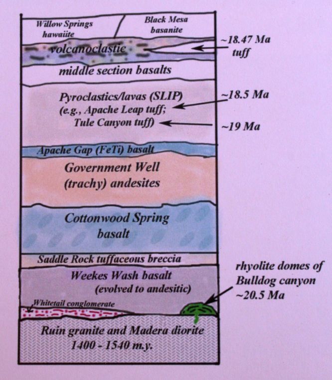
The image below shows the volcanic sequence exposed in the Goldfield Mountains, along with the older non-volcanic basement. Several of these units have been radioactively age-dated. The dated ages are indicated on the stratigraphic column below. The "Ma" symbol indicates million years before present, as does the "m.y." in the basement rocks. Notice the large disparity in ages between the basement and the much younger volcanic rocks. The surface between them is called an "unconformity" and represents time that has elapsed that has left no rock record at this location.
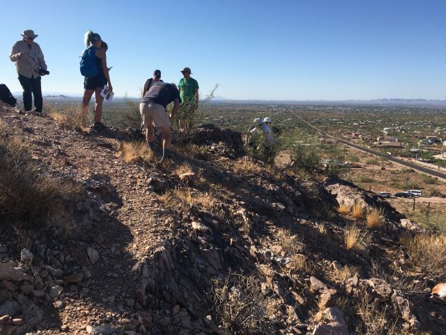
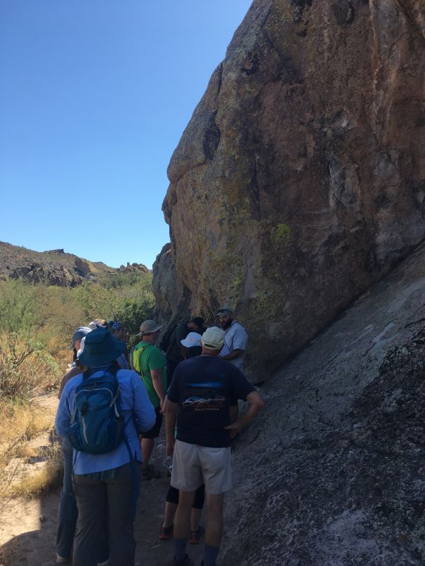
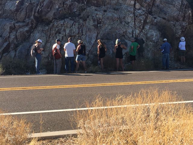
The image below shows a group of geolgists who have climbed upward on an eroded portion of a rhyolite dome (indicated as a dark green on the stratigraphic column above). This was a geological stop on a field trip associated with the 2019 National Meeting of the Geological Society of America, which had indoor meetings at the Convention Center in downtown Phoenix.
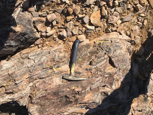
The image below shows flow banding structures within the rhyolite of the dome. The rhyolite was dated as 20.5 million years and lies on the Ruin granite, which dates at about 1400 to 1540 million years. The rhyolite dome represents the earliest volcanism in this part of the Goldfield-Superstition volcanic province.
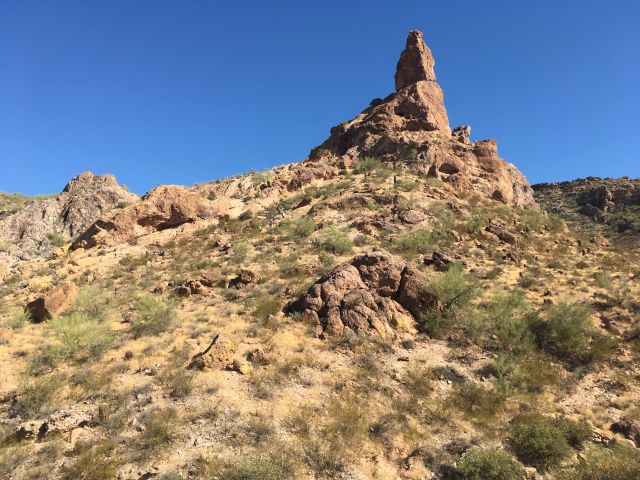
The spire in the image below is an erosional remnant in the volcanic ash deposits that overlie the rhyolite dome at this location.
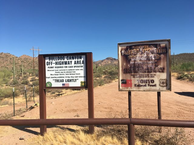
The image below shows the sign at the mouth of Bulldog Canyon where another eroded rhyolite dome is exposed. It also lies on the Proterozoic age Ruin granite, so this rhyolite dome is thought to be the same age as the previous rhyolite dome, which was dated at 20.5 million years. These domes signify the start of the volcanism that eventually formed the Superstition Mountains. They are exposed in the Goldfield Mountains because they were not subsequently involved with the collapse formation of the Superstition calderas and therefore avoided the subsequent caldera resurgence that ultimately formed the imposing Superstition Mountain block.
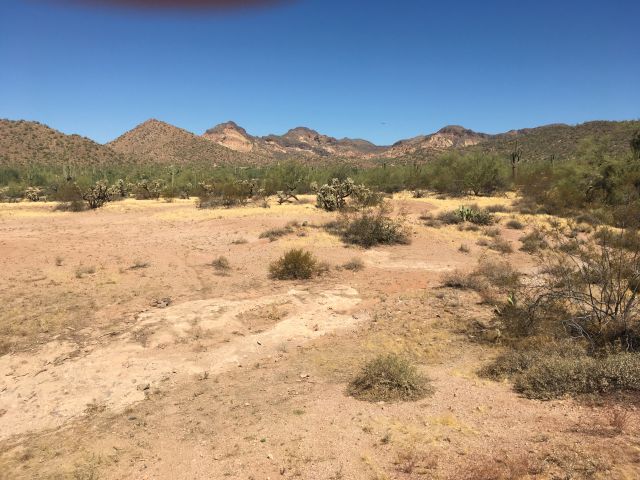
In Bulldog Canyon, the view below shows, in the distance, the light-colored rhyolite of the eroded rhyolite dome, which is covered by the darker colored layer of the younger Cottonwood Spring basalt.
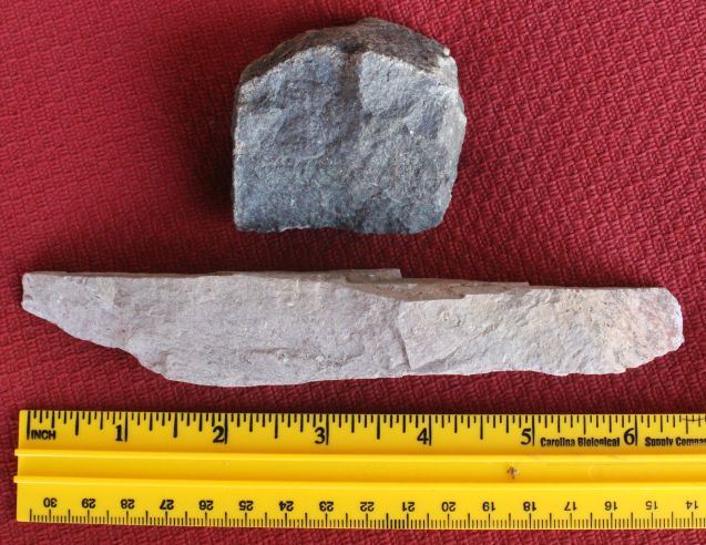
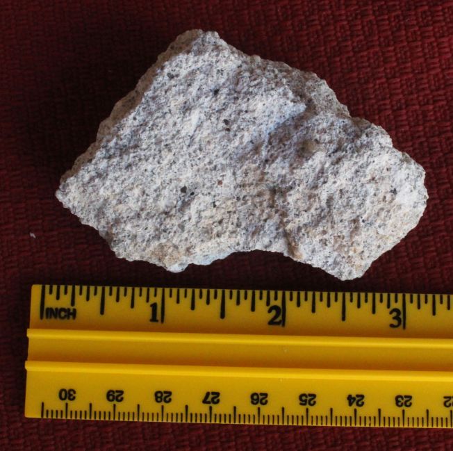
The image below shows hand specimens from both the lighter-colored rhyolite and the darker colored basalt from the outcrops above. At this location, the rhyolite exhibits an unusual "pencil cleavage" which produces fragments that have elongated flat surfaces in two of the three dimensions. The basalt does not share this unusual breakage property. Both specimens are fine grained.
The image below shows the entrance to the First Water trailhead. This path provides access to an exposure of the Apache Leap ash-flow tuff.
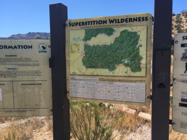
As seen in the image below, the First Water trail leads to an outcrop of the Apache Leap tuff. The tuff was dated as 18.5 milllion years in 1998 and the date was refined to 18.803 million years in 2017.
The image below shows a hand-specimen sample of the Apache Leap ash flow tuff. It is described as being crystal-rich, in contrast to the crystal-poor, and slightly older, Thule Canyon tuff, which is portrayed as the last image of this webpage. The age difference between these two volcanic rocks is reported to be about 1/3 to 1/2 million years.
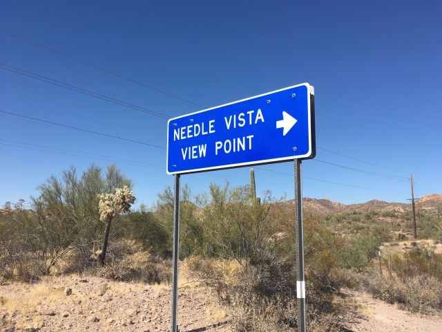
The Needle Vista Viewpoint is located along Apache Trail highway (route 88) and provides pavilions and a parking area for observing in the distance an attractive erosional remnant called Weaver's Needle.
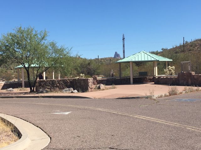
The image below shows two pavilions at the Needle Vista View Point and Weaver's Needle in the distance. If you park in this lot and walk across Apache Trail highway (route 88), you can enter a dry wash and walk up the wash to see good exposures of the Whitetail conglomerate, which dip to the northeast in this area.
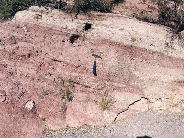
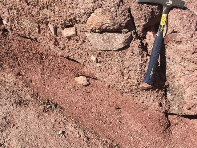
The image below shows the Whitetail conglomerate, which is well exposed in this wash. Like the rhyolite domes, this deposit unconformably overlies the Ruin granite, so is younger than that ancient rock, and it underlies the volcanics of the Superstitions, so is older than them. Interestingly, this deposit contains abundant angular rock fragments, so it probably formed in down-faulted valleys from desert mudflows. None of these fragments are volcanic, so it certainly predates the start of the volcanism that formed the Usery, Goldfield and Superstition mountains.
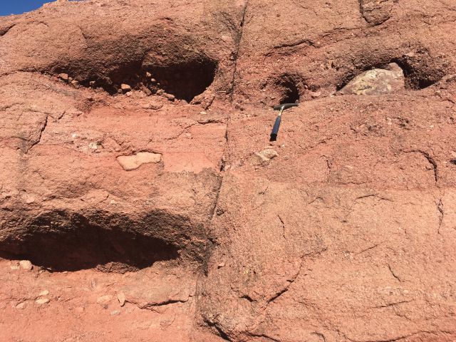
As seen below, some of the angular rock fragments in the Whitetail conglomerate are very large, attesting to the violent mudflow mechanism of their formation. Flash floods carried these large rock fragments in a flowing mud matrix in local stream channels. This repeatedly occurred in an oxidizing atmosphere, so most available iron would be oxidized in this environment to form iron oxides, which have a red color.
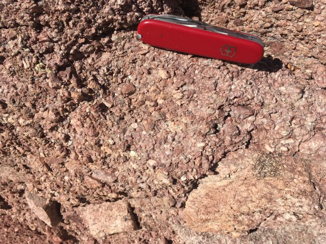
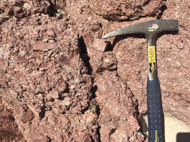
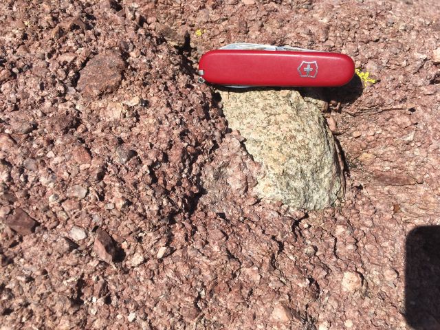
The next four images show the angular textures of the clasts within the Whitetail conglomerate. None of the clasts are volcanic, indicating that the Whitetail conglomerate predates the start of the volcanism that formed the Superstitions, the Usery, and the Goldfield Mountains.
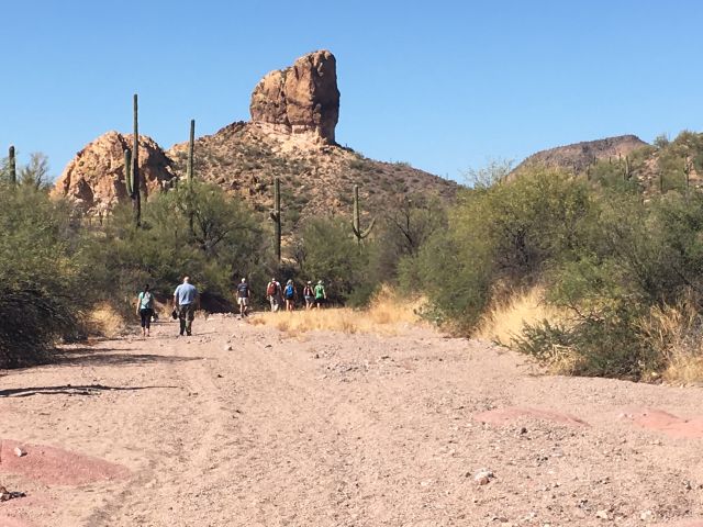
The walk up the arroyo is easy. On the image below, an erosional remnant of the younger volcanic deposits of the Superstitions can be seen overlying the Whitetail conglomerate.
The Canyon Lake Vista pullout, on the Apache Trail highway (route 88), provides parking and an attractive view of Canyon Lake and the surrounding volcanic deposits.
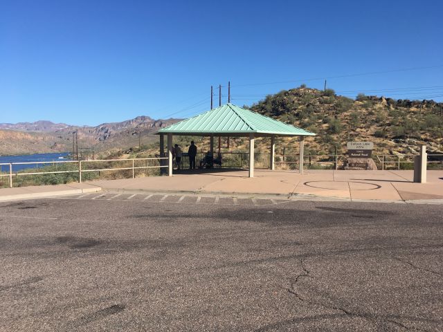
Directly across the highway from the pullout is an exposure of the crystal-poor Tule Canyon ash-flow tuff. This unit has been dated as 19 million years on the stratigraphic column at the beginning of this webpage. It is about 1/3 to 1/2 million years older than the crystal-rich Apache Leap tuff which is exposed along a trail at First Water.
Recent research (Mohr, 2015) has interpreted this crystal-poor Thule Canyon tuff and the crystal-rich Apache Leap ash-flow tuff as both having erupted from a single compositionally and texturally zoned magma reservoir that formed by crystal-liquid segregation.
References
Fodor, R. V., Mohr, M., and Dombroski, B., Lava and Pyroclastic Flows of the Miocene Goldfield-Superstition Volcanic Province, Central Arizona, Geologic Society of America Annual Meeting, year-2019 Field Trip, 21 September 2019.
Mohr, M. T., 2015, Crystal-poor and crystal-rich ash-flow tuffs in the Goldfield-Superstition volcanic province, central Arizona: evidence for a compositionally zoned magma reservoir formed by crystal-liquid segregation. Masters Thesis, North Carolina State University, Raleigh, NC, 122p.
Skotnicki, S. J., and Ferguson, C. A., 1996, Bedrock geologic map of the Apache Junction and Buckhorn Quadrangles, Maricopa and Pinal Counties, Arizona. Arizona Geological Survey Open File Report OFR-96-08, 2 map sheets, map scale 1:24,000, 16p.